Tuesday, December 23, 2014

Raven Rocks (Appalachian Trail – Northern Virginia)

Tuesday morning started off with low clouds and just a little chill when I woke up. I put the chicken and Cajun sausage stew that I had prepped the night before into the slow-cooker and filled my Camelbak container with water. Then, I went to get breakfast and coffee and head out to Raven Rocks, which was located in Bluemont, Virginia.
I had wanted to do a little segment of the Appalachian Trail since I finished reading A Walk in the Woods by Bill Bryson. The book outlined the history of the Appalachian Trail, which is relatively recent—within this century. According to the Appalachian Trail Conservancy, a former forester by the name of Benton MacKaye, decided that there needed to be a refuge from work, a “super trail” that went from the highest peak in the North to the highest peak in the South.
Although MacKaye promoted the trail, hikers set about creating the first sections and designing that iconic diamond trail marker. MacKaye, in 1925, formed an organization to concentrate on bridging existing trails to create a single long-distance trail. Nothing happened, though, until three years later, when Myron Avery joined the cause and MacKaye became less active.
Avery was able to get activists and hikers to start blazing and identifying routes while also negotiating with bureaucratic administrations to establish routes. His local clubs started to create maps and guidelines. After all was done, the AT went from Mt. Oglethorpe, GA to Baxter Peak on Mt. Katahdin in Maine.
Unfortunately, things were put on hold during the chaotic years between the Great Depression and World War II. Then, when things started to pick back up in the 1950s, the trail was threatened by highways and private lands, which Avery had tried previously to prevent. The ATC’s chairman at the time, Stanley Murray, went to DC to negotiate for protection.
Now, the ATC spends most of its time protecting the AT and maintaining the trails, which is difficult with the increase in backpackers, day hikers, and thru-hikers threatening the wilderness that the AT travels through.
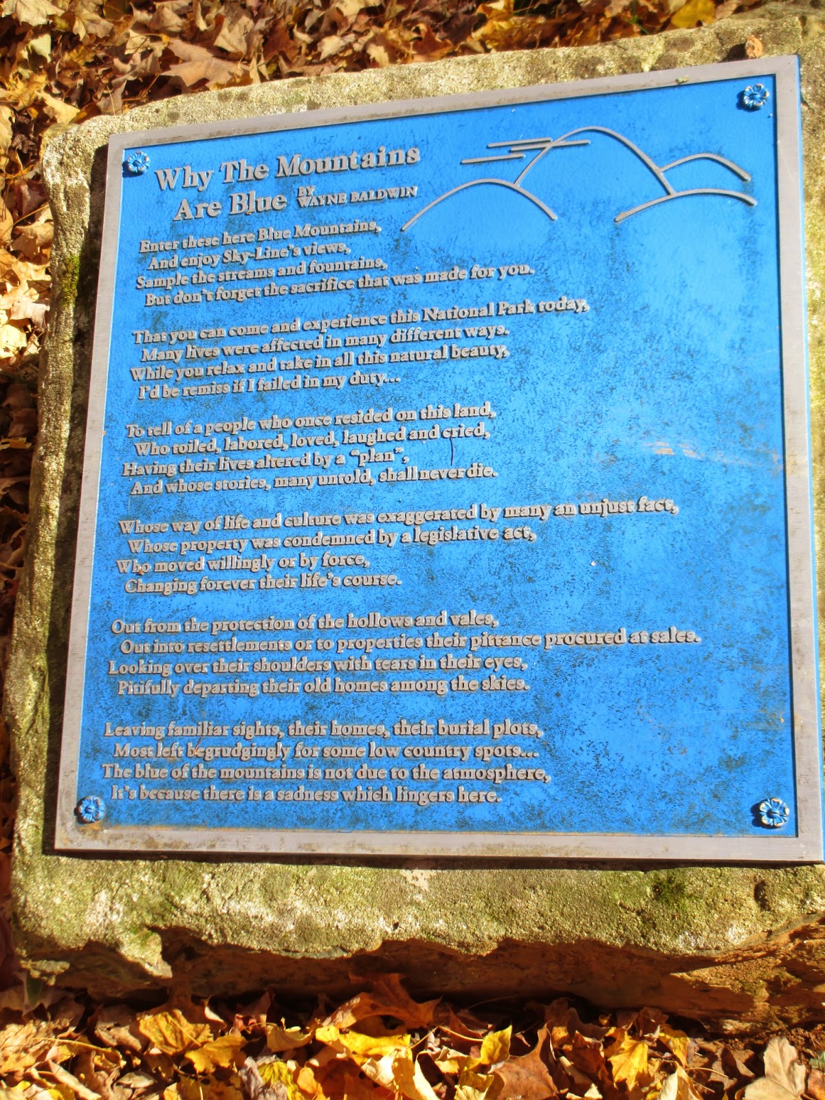
There is more to the history, such as the animosity between MacKaye and Avery, which you can find in books, on the ATC website, and throughout the internet. This synopsis is just to show what an amazing feat the AT truly is. Without the US government and these men, there would be no AT and no long-distance hiking.
Anyways, I decided to go on a hike from Route 7 in Bluemont, Virginia on the AT. I knew that the hike would be a little more strenuous than my usual day-hikes on Tuesdays, and the weather was dreary, with a lot of fog, but I was excited to get going.
I drove almost an hour and arrived at the trail head parking lot, which was completely empty, around 10:20 in the morning. As soon as I opened my door, the rain started to come down in earnest. My day pack was already getting soaked before I even grabbed my trekking poles from the trunk. No complaint out of me, because this was the third Tuesday that it had rained. I missed hiking and I wasn’t going to let some chilly water ruin my day.

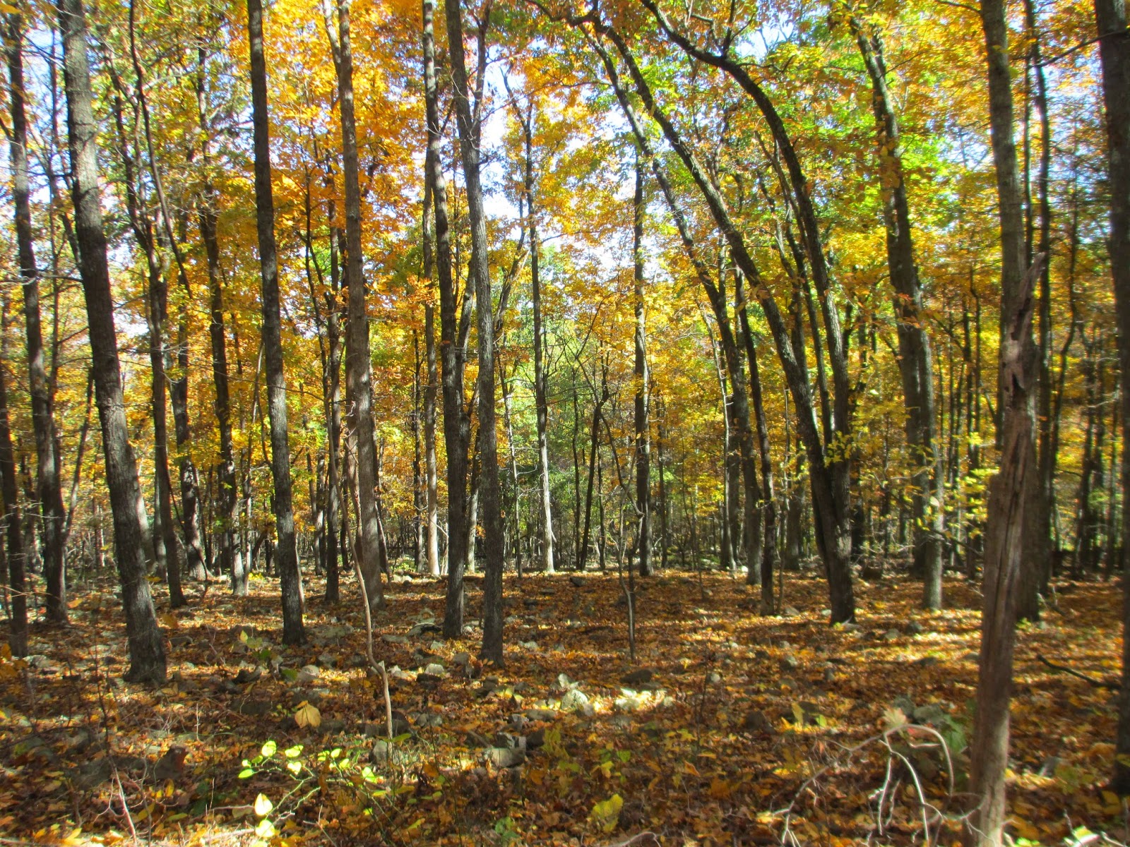
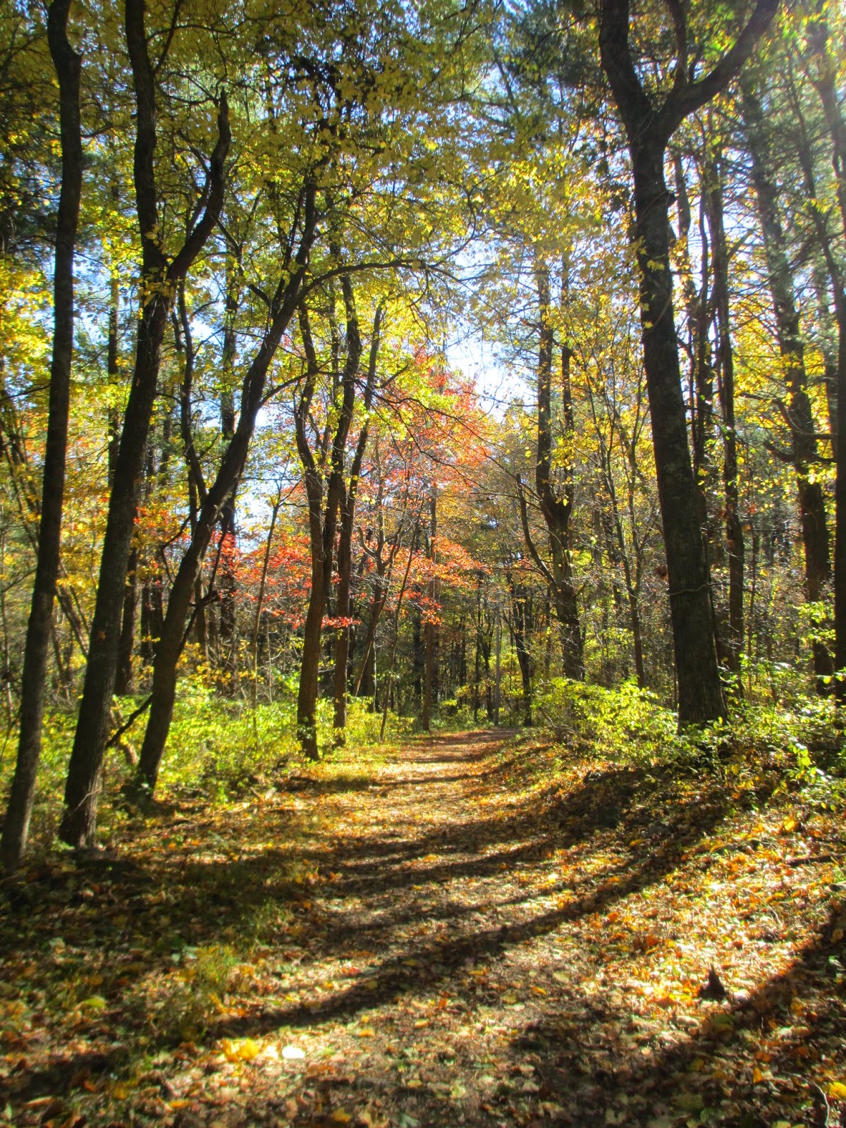
I grabbed my umbrella, hoping to keep my pack from getting completely drenched, and started up the built-in steps to the first ridge.  I held a trekking pole in my other hand to keep from slipping on the mud and leaves that littered the trail. Soon, my car and the trail head disappeared behind a screen of trees and fog as I slowly picked my way down the other side of the slope.
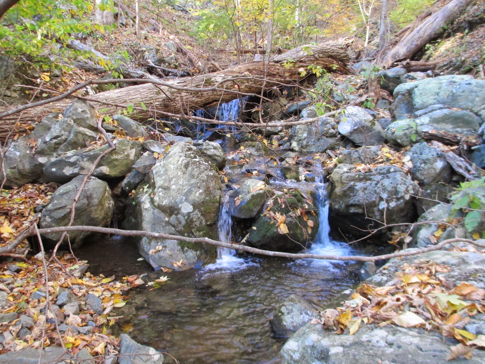
I realized I was in for a treat when the ground became strewn with rocks and boulders. I also discovered why this was considered the tail end of the famous “roller coaster” of the AT. There were three steep-ish climbs along the route. Two of the descents had a stream crossing at the bottom.

Within a half hour, I was gasping for air as I struggled up an incline. Gigantic boulders loomed off the side of the trail, barely visible through the mist. The trees creaked as they swayed in the wind. I lost the trail a few times through the obscuring fog as it switched back and forth, but thankfully the AT is well blazed, so I was quickly able to find the trail.

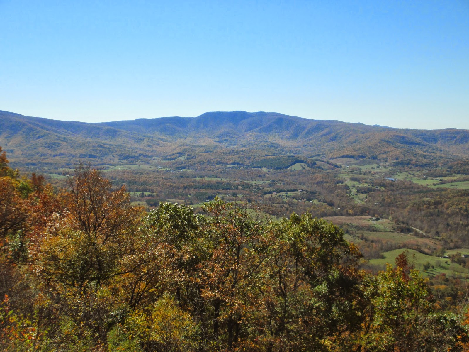
At the top of the incline, a large boulder sat off the edge of the trail, slick with wet moss, but inviting for me to climb nonetheless. I walked up its smooth slope to the peak and looked over the top. I could barely see through the mist and trees, but I saw parts of the Shenandoah Valley in the distance. A lone domicile with its farm nested between the two short mountains. I could still hear the traffic from Rt. 7 as it echoed down the valley.

I crested the hill and started to descend, and the rocks were starting to become larger. Soon the entire path was covered in rocks, and I had to balance from one to the next without slipping, using my trekking poles to keep myself from falling. It was a little harrowing, with my muddy boots slipping on rocks occasionally. My whole being, mentally and physically, was focused on where to place my next step and the next.

Near the middle of the descent, I noticed a sign that said “1000.” For a moment, I stopped and stared at the sign, my brain not realizing that this was the 1000-mile marker for the Appalachian Trail. I pondered whether this meant elevation for about a minute until I remembered my geography. It was interesting to see the second sign made from a privacy fence post, also saying “1000,” in bright green. I imagined trudging along for days and finally coming to this sign. It must be heart-breaking to walk for so long and only be 1000 miles along, with more than 1000 more to go.

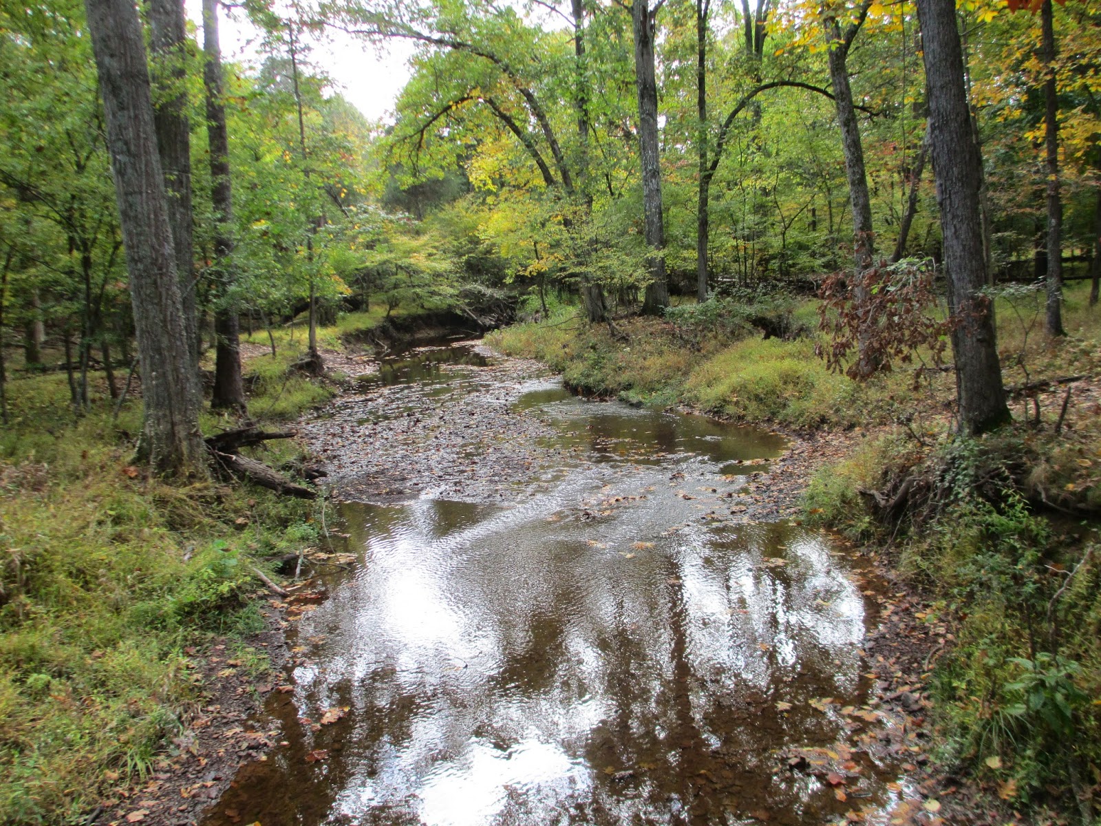
I carefully descended to the bottom, where a few small switchbacks meandered around the valley floor. I was rather thankful for the respite, but then I heard the water. I swore that I chose a part of the trail without a stream crossing, it being a rainy day, but I had already spent a good while on the trail and I wasn’t going to turn back.
The stream crossing wasn’t too difficult because the stream wasn’t large or deep. Large boulders as well as smaller rocks were perfect for hopping across, while my trekking poles dug into the soft mud. I was terrified of falling in. Being soaked in the chilly air would not have been ideal, especially when I was already getting damp from the mist.

The next incline was killer. It was more strenuous than the first, steeper with more boulders and rocks to hop and balance on. I managed to get halfway up when I stopped, leaned on my poles, and gasped for air like a fish out of water. What was I doing to myself? Was this going to be worth it? I always seem to have these questions at the beginning of a hike, when the exertion becomes more than I thought it would be.
I peaked the hill, twisting around and between trees, only to see that there was another descent. I began the descent, more confident in my stride now that I had started to get used to the poles as a balancing device. I took a step on a large, flat boulder that was sloped downwards and sank into the ground with only the top showing. My boot slipped and I went down. It was quick—I hardly knew what happened until I landed on my tailbone. Thankfully, I had placed my larger fleece in my day pack, so it cushioned my back and kept my head from touching the ground. I stood up, yelled a few profane words, rubbed my behind and took the next step. I was suddenly overly cautious of every step that I took, which made the next few meters take longer than they should have.
Around three quarters of the way down, the trail looked as if it ended. I stared over a ledge, where I could see the white blaze below, and wondered how I was going to get down there. I noticed that the rocks of the ledge made a natural staircase, so I started down, getting stuck rounding the corner. I always get twisted up when I go down crevasses and ledges, my brain forgetting that I need to have room to swing my legs downwards. I ended up pushing my poles as hard as I could into the ground as I squatted down and jumped to the next large rock. Fortunately, there was a small tree to grab on to, its bark well polished by thousands of hands from the people who have traversed this trail over the years. I picked my way down without further incident, proud of myself for not panicking and for thinking my way through the problem.
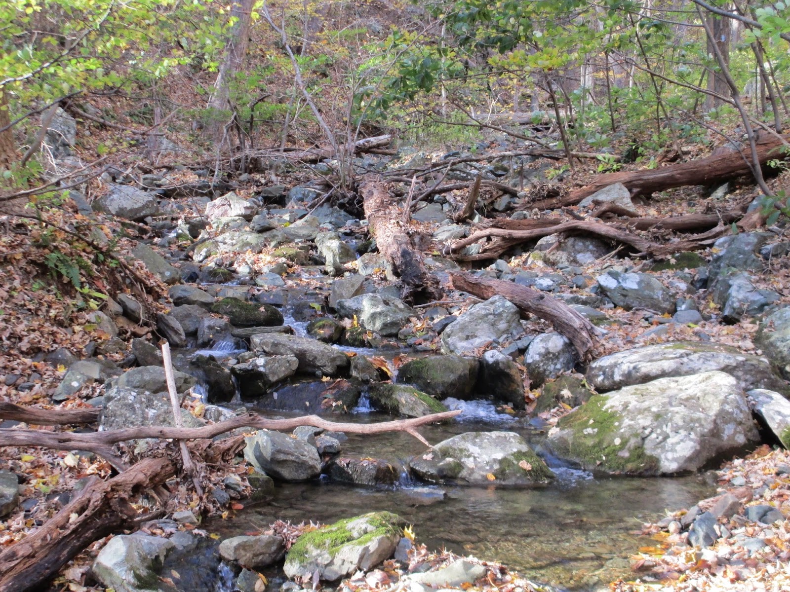
There is water under here...somewhere...
The trail was gradually downhill at this point, until I could hear more water bubbling from somewhere. I looked ahead and saw what looked like a river of rocks and boulders. I couldn’t see the water, but I could hear it. I carefully picked my way across, making funny noises as I bounced from one stony surface to the next for entertainment and calming purposes.
On the other side, I realized that I was going up again. No wonder they called this the “roller coaster.” Truthfully, all I wanted to do was sit down and take a break. I looked at my topographic map, making sure that I hadn’t accidentally missed Raven Rocks, which I hadn’t, and kept moving. This was the longest of the inclines. At one point it leveled out, dipped a little, and then headed back up again. Finally, I was staring up at the steepest part of the entire trail.
I started to climb up, bracing myself with my poles to help my poor knees, which had started to ache a little. Maybe I had picked a trail that was too challenging for me, but I was determined to go up. The rocks made natural steps in most areas, so I was able to simply walk on top of them. In a few places, I played a little game of the-ground-is-lava for a little entertainment as I continued to gasp for breath. Several times, I stopped and leaned into my poles to catch my breath. It’s rather difficult to breathe in the cold air, especially with asthma, so I had to be careful.

I was at mile two by now, only making a mile every 49 minutes or so. I was beginning to wane as I burned more calories. Finally, I found the West Virginia-Virginia border, marked with a small wooden sign off the side of the trail. A sudden flow of energy flooded me as I realized that I was going to walk across the border to another state. How awesome! Like a little kid, I bounced back and forth over the imaginary line, joyfully singing “I’m in West Virginia, now in Virginia, now in West Virginia” for a few times and took pictures to send to my mom, who worried about me while at work.
After a few minutes of playing, I decided it was time to trudge onwards. The trail up ahead, still on an incline, was surrounded by a small tunnel of bramble. The vines were still green, with a few leaves still on them, but mostly just composed of thorns waiting to scratch the unobservant.

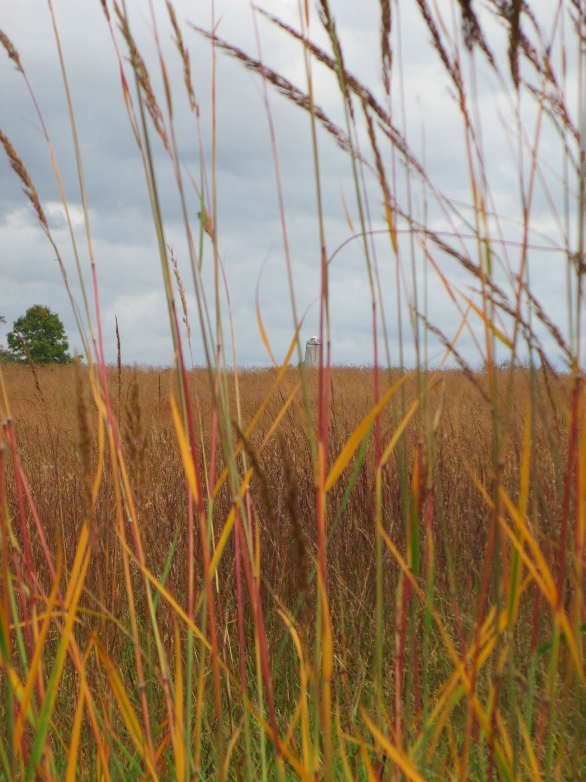
Suddenly, the whole trail opened up and I was there! Two and a quarter miles from the trail-head, almost two hours later, I reached Raven Rocks. The lookout was made of several rock formations that sat on top of a ridge. The wind gusted here, making the few squat pines on the edge squeak as their branches rubbed against one another. I looked out from the lookout, but all I could see were the clouds and fog below me, with a few glimpses of barren treetops as the clouds shifted.

I sat on one of the rock formations where someone had a fire at one point, unpacked my lunch of crackers, hard salami, and cheese, and stared into the mist. The rocks were damp and I shivered as the wind gusted, but I found peace in the moment. I wanted to stay there forever, but I knew that I had to return back before the sun set. I lingered for a moment more, watching as the fog started to gain elevation and started to cover some of the surrounding trail back. Guess it was time to return.

I started my return trip, heading southbound on the Appalachian Trail and back to my car. After warming up again in the first thirty minutes or so, my mind went into a trance-like state. I couldn’t feel the burn in my glutes and quads as I hiked along. My brain didn’t need me to focus on each step.

I walked back across both stream crossings, cursed at the rock that made me fall, and climbed the ledge without incident. I was on auto-pilot until I realized that Bing Crosby’s Mele Kalikimaka (Hawaiian Christmas Song) was stuck in my head. I tried to force it out, but nothing would do so and I gave up, listened to the white noise of the wind, and allowed the quiet meditative state to come back.
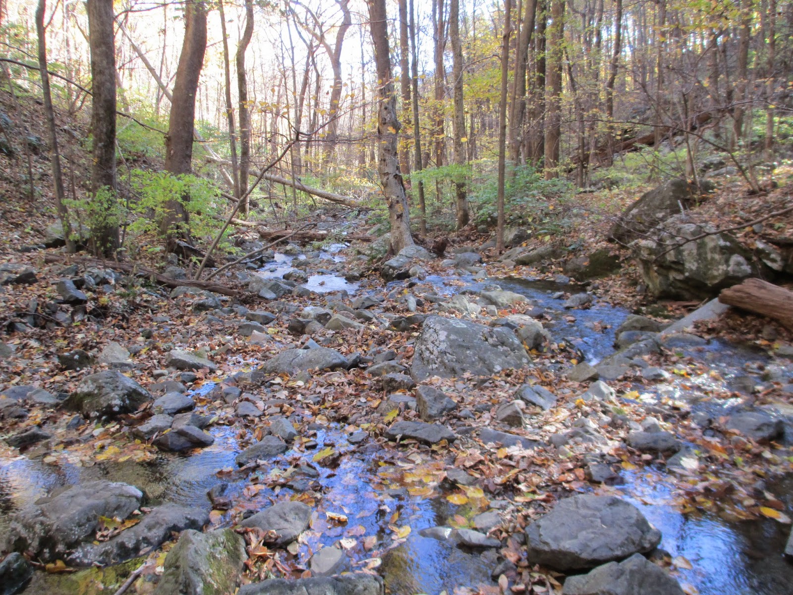
At first glance, I imagined it had snowed.
Surprisingly, the last ascent was the hardest on the return trip. It wasn’t because it was overly steep, but it seemed so long after all the work I had already done. The trail switched back and forth, with rocks that were ready to trip my tired legs. Halfway up, I found a nice boulder on the side of the trail that I could sit on and just rest for a moment. I took the time to drink water and check in with C and my mom. I listened to the wind rustling in the trees overhead and the soft sounds of the few birds still lurking around. I watched as the sun lowered below some of the mist that was heading my way. Finally, I stood up and made it to the end of the trail, where the mist was so thick that I could barely make out my car below.

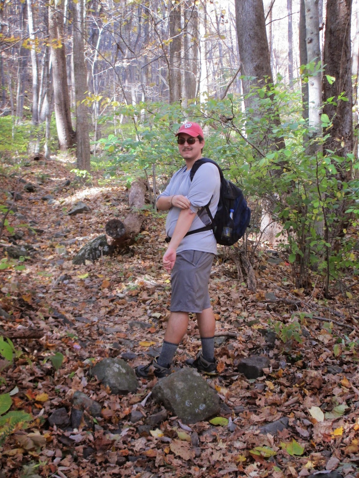
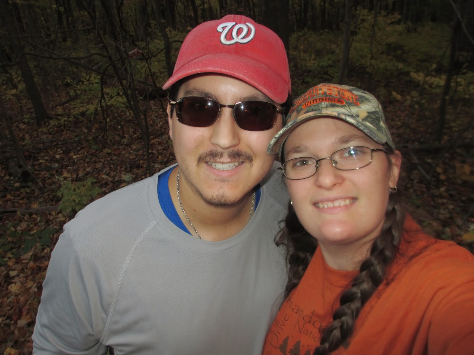
To be honest, I thought that this was not as challenging as the Billy Goat Trail A and the Little Devils Stair that I had previously hiked, but it was exhausting work. The pay off was amazing and well worth the effort. It would be one of those great spots to have a picnic during the warmer months or read a book away from the world. I was so happy that I had hiked the trail that I couldn’t wait to do it again with C in tow, which is exactly what I did on Sunday, a mere five days later.
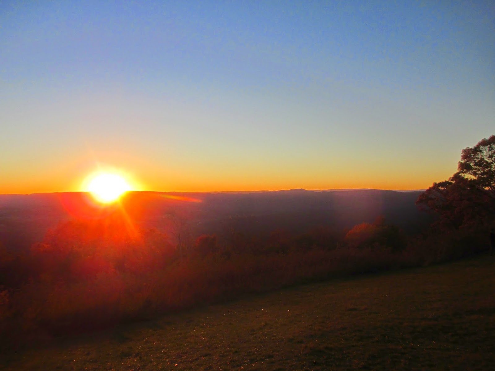
On top of Raven Rock on Sunday! Beautiful! 

The second trip was better—no slick rocks and a fun hiking partner. There were more people and dogs on the trail, but we managed to snag the Raven Rocks alone for our picnic of grown-up lunchables (crackers, cheese, and salami) and a piece of dark chocolate. We walked about half a mile longer, trying to find the Blackburn trail cabin owned by the Potomac Appalachian Trail Conservancy (PATC), but turned around when we realized the time and incline.

So far, this is one of those places that I could return to over and over again. I’m so glad I got my 20 seconds of confidence and just did it, rain and all. One of these days, I’m going to try to backpack from Rt. 7 to Harper’s Ferry, spending the night at either Blackburn Trail Cabin or the shelter a mile or so beyond.
Until next time!

Sunday, November 30, 2014

Fox Mill Trail and Keyser Fire Road - Little Devils Stair Lariat (Shenandoah National Park)

Shenandoah is the home of the eastern ridges of the Appalachians in Virginia, where the ancient rolling mountains create beautiful vistas for hikers of all abilities. The summits may not be as high as the Rockies, but the history contained within the mountains spans millennia. Shenandoah National Park spans 105 acres of majestic mountains with probably the best scenic driving on the East Coast, especially during the fall.

I had been planning to go to the Shenandoah National Park for quite some time. I was afraid to do some of the hiking trails because the majority of the trails are rather strenuous, especially those like Old Rag Mountain, but my desire to venture into the mountains was stronger than my fear.

On Sunday, October 25th, C and I left the Northern Virginia area around 9:30 am, after packing a cooler with our turkey, colby jack cheese, a few extra seltzer waters, and apples.The directions forced us to drive down I-66 west towards Front Royal, where I spent most of my time fussing at how people drive, which was mainly slow (C swears that all Virginians drive slow). I think that, perhaps, I was too excited and I wanted to get there quickly.

We arrived in Front Royal around an hour later; however, my GPS app on my phone decided to send us in the opposite direction, so we spent a few extra minutes going through the wrong part of town and turning around to head back the way we came. Note to self: read the signs along the street: they tend to not be wrong.

Finally, after the $15 entrance fee was paid, we started to head to the Dickey Ridge Visitor Center, which was four miles past the entrance along Skyline Drive, the beautiful scenic road that travels through the entire park. Around the first bend, though, I ran face to face with a rather skinny deer with a tracking device around its neck standing in the middle of the road, meandering slowly to the other side. Thankfully, I wasn't going too quickly, so I was able to wait until she finished crossing.


At the Dickey Ridge Visitor Center, we quickly found a beautiful windy vista where a lot of the park visitors hung around. The wind was extremely chilly and I hadn't come prepared with extra layers, even though I did bring a light jacket, so I urged C to go into the visitor center and into the gift shop. In the gift shop, I found an orange long-sleeve t-shirt that was perfect to keep me warmer against the wind.

We left the Dickey Ridge Visitor Center to start on our first short "warm-up" trail. I was the one leading, but I ended up taking us in the wrong direction yet again. C took one look at the map in my book and realized that we were heading away from the trail head, which was across Skyline Drive from the Visitor Center. I, apparently, was too excited to actually remember any navigational skills.


We followed the Fox Hollow trail loop to the left of the information kiosk and down a gradual downgrade. As we descended into the gully, the wind ceased to blow as hard and the temperature rose. The leaves stopped to swirl around our heads and the trees stopped creaking, leaving a peaceful silence. There were a few people milling around, but they seemed to turn back not too far from the trail head.


Near the bottom of the descent, before curving to the right, there were signs of large cairns of rocks on either side of the trail. The trees were changing colors, littering the eerie cairns with their fallen leaves. We also ran into an old cemetery from the mountain people who used to live in the Shenandoah Park before the US Forestry Service took over.


The rest of the almost two-mile trail was a gradual incline. We passed an elderly couple, hiking with their trekking poles and enjoying the sunshine on their faces as they slowly ascended the little vale. There was also a rather large family, the children climbing trees while the parents laughed and took pictures, further up. We could hear their screaming laughter before we saw them. We emerged from the trail from the right of the trail head and went straight to the car to head to the second, more strenuous trail.


The second trail was at mile marker 19 on Skyline Drive. We stopped at several different scenic overlooks to glance at the valley below and admire the mountains in their full glory while we headed towards our trail head. Several scenic overlooks were packed with people trying to take pictures or stare. At each stop, there were the lone hikers, the romantic lovers, entire families, and retired couples enjoying the views.


At mile marker 19, we found the trail head for the fire road on the left. I quickly parked so that C and I could have our sandwiches for lunch before we started our seven-mile hike. We ate our sandwiches on the trunk of my car, enjoying the sun on our faces, and watched a gang of motorcyclists come into the small parking lot and park across from us. After rehydrating and feeling full, we started the gradual four-mile descent on the Keyser Fire Road, a nice wide trail with some nice overlooks.


The Keyser Fire Road was nice, with autumn-colored trees on both sides of the trail. It meandered slowly down the side of the mountain and into a little valley. We passed several people ascending as well as a few people descending. I marveled at some of the clothing choices the women were wearing. Did they know they were doing hiking or was it a surprise?


Eventually, the downhill traveling started to strain the quadriceps and knees. We were walking quickly to try to get to the bottom. I never thought that going downhill would take so much out of me. At mile four, we decided to have a quick snack break and found a spot to sit down and give our legs a little bit of rest. I had some springbok biltong from South Africa and a small bag of dried fruit, seeds, and nuts, while C had a more traditional trail mix.


Near where we turned left to head towards the second part of the trail, we found another small cemetery. A father and his small child were investigating the stones. There was a blue plaque in the middle explaining the Blue Ridge Mountains that I thought was well written, albeit morose.


After we turned left, we headed downhill some more before seeing a random parking lot and signs that told us we were in private property. We crossed the parking lot, where I saw a family enter the wooded area. At the next trail head to the Little Devils Stair, I actually found the post sign for the trail as well as a backcountry sign telling hikers what they can and can't do while in the area.


The first thing we saw when we started the trail was a stream crossing with large boulders that we thought would have been the greatest picnic spots. The large boulders were off to the side so no one would be in the way, and you could dangle your feet over the stream without getting wet.


We started our uphill climb shortly thereafter, following a narrow trail through the trees until we could hear the sounds of water cascading. The birds were chirping merrily and the rustling of the wind through the trees died down considerably. I ended up having to start taking off my layers because it was almost hot while climbing upwards.

Caught C in the act of rolling up his shirt sleeves

The noise from the cascading water got louder as we neared and we started to see the bottom of the gorge that is the Little Devils Stair. I was enthralled, but little did I know, I would get very well acquainted with the stair.


The next few pictures will show the actual trail as it turns into a rock scramble. This is one of the more challenging rock scrambles that I have done besides that of Great Falls National Park, but there was no turning back now. We crossed the Little Devils Stair almost each time the rocks leveled out after a cascade, but I lost count after an exhausting five crossings.

C getting ready to do the first crossing


There were points in the trail when we didn't know where the trail actually went. Thankfully, whenever we stopped to catch our bearings, we found a light blue blaze telling us which way to go, and usually it was across the Little Devils Stair again. There were also times when we would look and the trail would go missing, but natural staircases pointed the way up.


After about a mile of rock scramble, around mile 5.5 or so, we finally reached the top of the Little Devils Stair. There was still a gradual incline, so my legs were still screaming from abuse. I was also limping slightly because I had twisted my ankle on a crossing, but we made it make to the Keyser Fire Road. We followed the fire road back to my car right as the sun was starting to set. The colors of the autumnal leaves were brilliant as we drove back up Skyline Drive.


The journey was exhausting, but worth every little effort. I plan on returning back to the Shenandoah, especially for a multi-day hike in the summer. I am so grateful that Virginia is as beautiful and diverse as it is.


** Very late in posting, but I wanted to do the hike justice. I decided to go the picture-heavy route because the pictures were better than my prose. I hope you enjoyed them!

Sunday, October 19, 2014

Second Battle of Manassas (Manassas National Battlefield, VA)

It was late August in 1862 when Stonewall Jackson and his men captured Federal commander John Pope's supply depot in Manassas junction. Pope, upon finding out the news, abandoned his post behind the Rappahannock to pursue Jackson, who had slipped away and took up position near the battlefield of the first battle of Bull Run.

Jackson struck a lone Union division near Brawner Farm on the evening of August 28th, knowing that General Robert Lee and his contingent of soldiers would arrive the next day. Pope commanded his forces, already scattered, to slowly attack Jackson's, who were positioned along an unfinished railroad on August 29th. Pope's forces were able to penetrate Jackson's forces, but were driven back each time. Lee arrived late in the morning with hopes to use Longstreet's forces for a flanking maneuver, but Longstreet persuaded Lee that the attack wasn't favorable. 

The next day, Pope was conflicted, as his intelligence could not tell him exactly what the Confederates were doing. He decided that they were retreating, so around midday, he ordered an attack that soon ended when his forces encountered Jackson's hidden forces along the unfinished railroad, resulting in a major assault on Jackson's line. At Deep Cut, a section of the unfinished railroad that was still just a hole, the two union forces tried to attack the right flank. Porter's corps traversed the fields of Dogan Farm while Hatch's brigade were stuck at the railroad embankmant after crossing a brief stretch of exposed ground. Some of the  Confederates were getting low on ammunition, so they were forced to hurl rocks at the Union soldiers, resulting in a large rock fight simply to defend their position. Finally, help for the Confederates arrived as a fresh brigade of A. P. Hill's division forced the Union force to flee. Porter's corps suffered severe tragedies during the retreat, leaving behind heaps of their dead. Jackson, too exhausted, was unable to organize a rapid pursuit of the retreating Union soldiers, allowing Porter to secure a position north of Warrenton Turnpike.

Confederates throwing rocks
http://civilwarriors.net/wordpress/wp-content/uploads/Rock-fight.jpg

At Chinn Ridge, the Union forces under Irvin McDowell, who feared for Porter and his men's safety, tried to build a defense. McDowell made a severe tactical mistake when he ordered Reynold to move his men across the turnpike, leaving only 2,200 men to oppose more than ten times that many Confederates. 

Lee and Longstreet, hearing the news, schemed a massive attack against the Union left, with Longstreet's division heading toward Henry Hill to cut off the Union escape while Confederate leader John Bell Hood and his Texans opposed the Tenth and Fifth New York Zouaves. The thousand men deployed in skirmish formation along Lewis Lane, almost annihilating the regiment, killing the most men in ten minutes of any regiment in a single battle throughout the entire Civil War.


https://afatherswarstorynevertold.files.wordpress.com/2013/12/1st-battle-of-bull-run.jpg

At this point, Pope and McDowell finally understood the consequences of their mistaken strategies and tried to salvage the battle to save the rest of their army. Pope ordered the Union soldiers to occupy Henry Hill, which took a considerable time. Pope ordered Nathaniel McLean and his Ohioans to purchase time by firing their artillery on the Confederates as they advanced from the grim slopes of Chinn Ridge. 

Hood, in order to recapture the Confederates' momentum, ordered Evans to shift his regiment to the south and towards the Union's left flank. Unfortunately, Mclean deployed two of his units, forcing Evans to regroup in some piney woods. The Union line held, for the moment. 

Montgomery Corse, a former milita officer from Alexandria, came to the Confederates' rescue by approaching Evans at a right angle. Due to the dark uniform of the Virginia Brigade, the Ohioans of McClean mistook them as friends, allowing them to get closer without any opposition until they realized their error. Suddenly, the Ohioans started to fire and battle commenced at point-blank range for ten minutes, until a Louisiana artillery battery joined in the foray, collapsing McLean's line at last.

http://fusilier.files.wordpress.com/2012/08/2nd-manassas.jpg?w=538

Meanwhile, Longstreet needed help to obtain Henry Hill from the Federals. Lee decided to move soldiers from Brawner Farm; however, several commands couldn't make it in time, including Hood who was still in combat at Chinn Ridge. Neighbor Jones took up the responsibility and sent G.T. Anderson and Benning's Georgians, who unfortunately lacked discipline. The Union line was able to use that lack of cohesion to halt the Confederates with firepower. Although other commanders came to help and Lee's goal of Henry Hill could have been accomplished, Anderson stalled for an unknown reason, resulting in a squandered opportunity that was earned by several hours of fierce fighting.

Finally, on September 1st, the Confederates tried to flank Pope as he retreated, resulting in a bloody fight at Chantilly on Ox Hill. The Union quickly retreated toward Washington defenses, giving Lee the chance to lead his army across the Potomac and into Maryland for the Confederates' first chance to bring the fight to the North.

http://www.ozarkrambler.com/wp-content/uploads/2014/01/jacksonlee.jpg

The Second Battle of Manassas became the most costly battle of the Civil War, with thousands of men killed and wounded. The ground was littered with the unburied dead, while those who fought hurried to the next battle. Abraham Lincoln ended John Pope's Civil War career afterwards, giving his combined forces to McClellan.

General John Pope
http://www.history.com/news/wp-content/uploads/2012/08/general-john-pope.jpg


As I entered the Manassas National Battleground on October 14, 2014, a little over 152 years later, I decided to hike the Second Battle of Manassas. It's a 6.2-mile trek through some of the major positions of the battle, including Chinn Ridge and the unfinished railroad. Again, I grabbed my trail map for Manassas at the visitor center and set off.


It was a perfect day for the most part. There was a nice steady breeze that forewarned of a cold front coming in the following day. Tall, gray clouds crept along the mountainous horizon, but no rain was in the forecast. Cerulean skies peeped occasionally as the sun baked away clouds.


I first headed back along the First Manassas trail, bypassing Judith Carter's gravesite and a line of cannon as I headed to Route 29. It was a slight downhill section at this point, warming up my body for the uphill climb that followed. I crossed Route 29 and passed the Stone House, mentioned here in my first visit, and continued to climb up to Henry Hill, a pivotal plateau for both Manassas battles and a wonderful spot to really imagine soldiers trying to obtain such a great vantage point.


 On the downhill slope, I admired the first signs of fall. The colors blazing away as the clouds rolled past the sun. At this point, there was a junction where three trails crossed: the First Manassas Trail, Henry Loop Trail, and the Second Manassas Trail. I knew the latter was the one I needed, as I had already been on the first two, so I continued walking to the parking lot that led to the Second Manassas Trail.


 At first, I thought the trail simply ended, finding no real blazes to lead the way. I roamed the parking lot before thinking about heading back to the visitor center to ask for directions when I noticed a small sign, obscured by the sawgrass, pointing to the direction across Sudley Road.


After cautiously crossing Sudley Road, as there was no crosswalk, I picked up the muddy trail, dodging the horse manure that littered the trail. At this point, the Second Manassas Trail and the Bridle Trail merged and remained so for most of the hike. The mud made the hike a little more treacherous and exhausting, but still enjoyable.

The Second Manassas Trail opened up once I crossed the street, and I could see hawks floating serenely overhead on the thermals, twirling gracefully higher and higher. The clouds broke apart a little, silhouetting them against the sky.


After walking for a quarter of a mile in the open field, I heard galloping behind me as a man and his beautiful black mare ran around a bend. He reigned in, saluted me, and passed along my left. After being far enough away, he kicked his horse back into a gallop and disappeared along the lane that we had just entered. I tried to take a picture of them as they sped down the lane, but I was too slow.


Walking down the lane, I found this picturesque.

The lane ended in a deciduous wood, the horse trail veered off, and I was left on a slick, leaf-strewn path with the autumn leaves rustling in the slight breeze. The humidity was a little thicker here, with the trees more enclosed. I heard the scampering of squirrel feet and saw snippets of deer as they fled from my approach. In solitude, I found my inner peace.


I found myself in another parking lot, with the unfinished railroad loop heading off to the right. I meandered a little towards the unfinished railroad, but didn't do the entire loop. I started to really feel the echoes of the battle that had occurred, goosebumps prickling my flesh as I read the signage that told the story.


I left the unfinished railroad loop, skirting the parking lot, and headed back into the woods on the left. Here and there, rocks and boulders peeked out of the leaf litter, catching me unawares as my mind drifted to the battle that happened, wondering if this was Jackson's entire line strewn like the leaves. I bypassed several tall trees with the Witness Tree signs, meaning that these trees were old enough to actually have been in the battle's background. If only those trees could tell their story.

Random lichen/mushroom at the bottom of the sign reminds me of a green snowman


Suddenly, the trail opened on the left side to an expanse of exposed ground with slight steps leading up to an embankment. Large rocks were scattered along both sides. I then realized that this is where the infamous rock fight began -- where the Confederates had run out of ammunition and Porter abandoned his initiative. The knowledge that hundreds of Union soldiers were killed and abandoned here sent chills down my spine.


I then followed the trail into the exposed area of field towards Brawner Farm, which I had sadly missed, and towards Deep Cut Loop. The sawgrass waved, golden brown, in the breeze. Some areas reached over the top of my head. I imagined being a soldier, trying to navigate the tall grass while dodging artillery fire.


I soon found myself in front of a monument, looming out of the exposed ground like a monolith. The obelisk was erected by the Union soldiers in memory of the hundreds who had fallen. I could not determine if these were the ill-fated Porter men who were killed upon retreat or another brigade. Still, knowing that men had died to defend their beliefs made me pause.


The trail turned and meandered through the tall grass, leading to another little lane next to the road. The lane was bordered by trees on one side and the old farm-style fence on the other. The Bridle Trail for horses merged back on and I had to again watch my step, failing at one point on top of a small bridge that covered a little brook.


The lane ended at Route 29, where you have to cross cautiously once again after viewing the Dogan House. The trail picked back up along another exposed field, where a monument sat in the distance. I had hoped that the trail would go past the monolith so that I could see for whom it was erected, but, unfortunately, it snaked away in the other direction. It, also, led away from the Groveton Confederate Cemetery, a place I wanted to also visit.


The trail then led to New York Avenue, where the New York Zouaves were routed and almost annihilated. Stone monuments stood for both the third and fifth New York regiments, honoring the hundreds who lost their lives because of a tactical error.


I silently left, following the trail into the woods again, passing several more witness trees in the process. The autumn leaves fluttered down, raining silently on my head, as I somberly walked through the woods, lifting my spirits as I caught a few in mid-flight. I crossed Young's Branch and turned onto the Chinn Ridge Trail, mainly to skip out on the manure that still littered the Second Manassas Trail.


I emerged from the woods into another open field with hay bales strategically placed every few hundred yards. I had finally reached Chinn Ridge after 5.5 miles of walking. I read some of the historical signs, then walked over to the ruins of Hazel Plain. In the distance, the Hooes family cemetery sat, alone and quiet.


I jumped back onto the Second Manassas Trail as it merged with the Chinn Ridge Trail, following it up to a large rock and monument before a lone field. The rock was a monument for Colonel Fletcher Webster, who led the 12th Massachusetts volunteers. The small obelisk, recently erected, was for the Texans who gave up their lives to fight a war far away from home.


Finally, I descended a small hill between two trees and reached the road back to the visitor center. Along the way, I met two ladies with their very beautiful German Shepherds, who bounded towards me for some attention. I talked a little with them, then crossed Sudley Road and got back to my car. 


This hike was a beautiful hike -- my favorite between the two Manassas Trails. Although somber and chilling at times, I was able to fully enjoy the scenery and the history that the National Park had. I definitely plan on returning, reading more of the historical signage, and using this trail as one of my go-to trails. Wonderful!